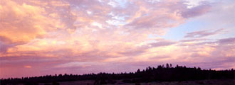
The Grand Canyon is located in Northern Arizona. It is over 250
miles long, has an average width of 10 miles and is approximately
1 mile deep. It became a National Park in 1919, and is divided
into several sections. These are the North Rim, the South
Rim, and the Reservations. Indians, Spaniards, and early explorers
all came this way.
It is 24-26 miles hiking (one way) to go from the North Rim to
the South Rim of the Grand Canyon. However, the road to drive from the North Rim to the South Rim is 225-250
miles one way.
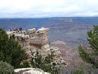
The South Rim of the Grand Canyon is where the vast majority of
visitors come. It lies at an elevation of between 6,000-7,500ft.
and is covered with forests. It has lodging, restaurants,
museums, and other tourist amenities. The South Rim is also
open year around, and has two drives. Most people stop at a few of the most popular lookouts, and never see more of the canyon than these few points.
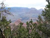
Due in part to its remoteness, fewer amenities, higher elevation,
and the fact that it is only open part of the year (when the
snows melt) fewer tourists reach the North Rim. With an average
elevation of 8,800-9,200+ feet, it is cooler and more beautiful
than the South Rim.
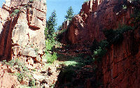
Mule Trips, River Rafting, and hikes longer than 1 day and off
of the Corridor Trails require back country permits. Hiking into the canyon takes research and preparation. Because of the nature of the trail and the terrain, you should not descend into the canyon unprepared. Buying a bottle of water at the gift shop is not preparation.
Every year, the park service rescues hundreds of hikers from the canyon. A majority of these rescued hikers claimed to be in good health, and experienced hikers. However, the canyon is absolutely unforgiving if you are not completely prepared. Heat stroke and dehydration are the major issues. Even with snow on the rim, the bottom of the canyon can be an oven.
If you are planning to hike the Grand Canyon, do your research, and make sure you get your backcountry permit. Your application will be one of about 30,000, and only about 13,000 permits are issued each year.
Hiking Trails include the North Kaibab Trail 14.5 miles
each way. The South Kaibab Trail is 7-8 miles each way and the
Bright Angel Trail 9.5 miles each way. There is no water on
the South Kaibab Trail. Hikers should be prepared as conditions
in the Canyon can quickly change.
Other trails include the Tanner Trail, Hermit Trail, Grandview Trail,
Hance Trail, Thunder River Trail, New Hance Trail, Bass Trail.
Other famous trails include Havasupai and the Nankoweap Basin.
The National Park Service, working with the Grand Canyon Association,
produces an informative newspaper called The Grand Canyon
Guide, which provides information about ranger-led activities,
a shuttle schedule, and visitor facilities within the Park.
They also publish the Trip Planner, a guide to help tourists
plan their visit to the Grand Canyon.
The
geology, wildlife, and history of the Grand Canyon are of particular
interest.
Location: 3.5 hours from Phoenix, about 276 miles from Las Vegas,
& 500 miles from Los Angeles. |